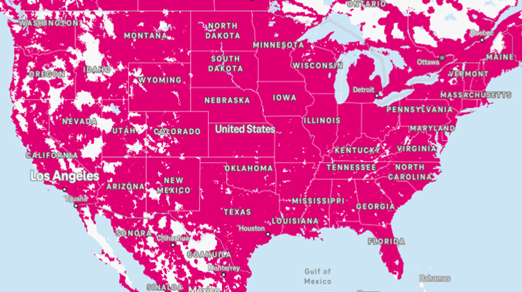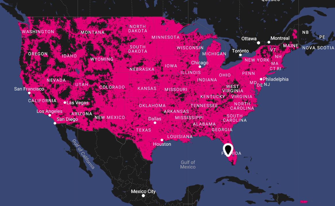
T Mobile Coverage Map Puerto Rico

There is a peculiar kind of magic in the Caribbean that has nothing to do with Taino legends or the ghost stories of El Morro. It’s the moment your phone, sweaty from the tropical humidity, flickers from “No Service” to a triumphant five bars of LTE. For the modern traveler and the digital-native local alike, the T-Mobile coverage map of Puerto Rico is less a technical document and more a modern cartography of survival, a Gall-Peters projection where the Mercator bias of mainland priorities is mercifully flipped. We are talking about the isle of enchantment—a place where the rain forests are denser than a conspiracy forum and the mountains create dead zones that feel like a digital detox you never signed up for. Yet, within this chaotic geography, T-Mobile has woven a network that is as nuanced as the island’s own history—a story of mergers, hurricanes, and relentless technological will.
The saga begins with a dark twist: before 2020, this map looked entirely different. It was a patchwork of Sprint’s aging infrastructure and T-Mobile’s aggressive expansion, a chaotic alliance that often left coastal tourists stranded in buffering purgatory. Then came the $26 billion merger, and with it, a promise to turn Puerto Rico into a 5G proving ground. This isn’t just about coverage; it’s about resilience. After Hurricane Maria in 2017, the island’s telecommunication grid was annihilated, exposing a fragility that mainland networks rarely experience. T-Mobile’s subsequent investment in battery backup, micro-grids, and satellite backhaul is not corporate fluff—it is a survival mechanism. When you look at that magenta map today, you are not just seeing cell towers; you are seeing the scar tissue of a disaster that forced a telecom giant to think differently about how humans connect when the sun goes down and the wind doesn’t stop.
The Cartography of Chaos: Why "Coverage" Feels Different Here
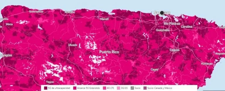
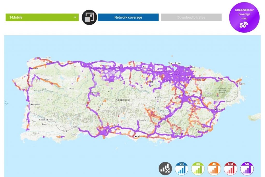
Pull up T-Mobile’s official map and you’ll see a lush, magenta blob covering 96% of the island’s population. But the map is a liar—a beautiful, optimistic liar. What the flat digital overlay fails to convey is the verticality of Puerto Rico. Unlike Kansas, where a signal travels unimpeded across wheat fields, Puerto Rico is a geological middle finger to radio frequencies. The Cordillera Central mountain range cuts the island in half, creating a natural amphitheater where signals bounce, refract, and die. In the town of Adjuntas, affectionately known as “The Switzers of Puerto Rico,” you can be standing in a coffee plantation with full bars, only to walk fifteen feet into a valley and lose your connection to civilization entirely. This is not a failure of T-Mobile; it is a war against physics, and the map is merely the propaganda of that war.
Must Read
The psychological impact of this fragmented coverage is profound. Puerto Ricans have developed a "signal sixth sense." They know that in Ponce, you stand by the statue of Juan Morel Campos for a WhatsApp call; in the metro area, you avoid the basement of Plaza Las Américas like a digital plague. This creates a unique cultural behavior: the "pueblo" walk. You see it daily—an elderly man ambling slowly down a hill, phone held high like a divining rod, searching for that sweet spot where the bars align. T-Mobile’s densification strategy, which involves sprinkling small cells on utility poles, has turned the island into a game of 5G hide-and-seek. What the map doesn’t show you is that the best coverage often lies in the most unlikely places: the ferry terminal in Ceiba, the top floor of a parking garage in Santurce, and strangely, the middle of the El Yunque trailhead—where the network engineers clearly had a sense of existential humor.
But there’s a darker, funnier side to this coverage war. In 2024, T-Mobile claimed a 5G "Ultra Capacity" signal blanket over the island. Yet, ask any local and they’ll tell you the secret etiquette: when you lose signal, you don’t scream at T-Mobile; you scream at the weather. The tropical atmosphere itself is a signal thief. Heavy rain acts as an umbrella for high-frequency 5G waves, creating a phenomenon locals call “the storm throttle.” During a typical aguacero (downpour), your speed tests plummet by 50%. It’s a dark fact that the network that saved Puerto Rico after a hurricane ironically chokes on a drizzle. This has birthed a subculture of "weather-optimized texting"—waiting for the rain to pause before hitting send on that iMessage with a video attachment.
Surfing the Magenta Wave: Scenarios, Strategies, and Sanity
Let’s get tactical. You are a digital nomad landing in San Juan with your laptop and a dream. The T-Mobile map says you’re in a 5G paradise. You will find this true in Condado, where speeds hit 800 Mbps near the Ashford Avenue strip. But your phone is a lie detector, not a map reader. Scenario one: you book an Airbnb in Old San Juan, specifically on Calle del Cristo. The cobblestones, the thick colonial walls, and the proximity to the fort create a signal Faraday cage. In this scenario, T-Mobile’s Bands 71 and 41 struggle against 400-year-old masonry. The actionable takeaway? Use your phone’s WiFi calling feature aggressively, or hop to the nearest café using fiber optic. The map is for rangers, not for city mice.

Consider the case of Maria, a field researcher in the karst country of Morovis. Her job requires GPS tracking in caves where sunlight never penetrates. T-Mobile’s coverage map fails her utterly underground, but here’s the practical insight: the network excels at edge-to-edge recovery. When she exits the cave system, her phone reattaches to the network in under three seconds, faster than her Garmin resets. This "rapid reacquisition" is a hidden feature of the network’s architecture. For the adventurous, the strategy is not to rely on constant coverage, but to use T-Mobile’s offline maps in Google Maps and download Spotify playlists for the mountain drives. The map is a promise, but your pre-planning is the legal contract.
For the local entrepreneur in Caguas, the scenario is about business, not leisure. The coverage map’s dense 5G overlay means their mobile hotspot can run a point-of-sale system at a farmers market. Yet, the dark fact is bandwidth deprioritization. After 50GB of data, your "unlimited" plan becomes a tortoise. During peak hours (6 PM to 9 PM), the map’s beautiful magenta color turns to a misleading gray in practice. The actionable takeaway here is to schedule heavy uploads for 2 AM, a time when the island sleeps and the backhaul is as clear as the bioluminescent bay in Mosquito. I’ve seen a video editor in Rincón struggle to upload a client edit during a sunset—a beautiful visual, a frustrating digital experience. She learned to use the "Cloud" upload queue and let it run overnight, effectively bending the map to her will.
Finally, the hurricane scenario. This is where the T-Mobile map transforms from marketing material to a survival kit. Post-Maria, T-Mobile deployed "mobile cells on wings"—drones that fly tethered to a tower to provide coverage in stadium-sized areas. When a tropical storm warning hits, savvy locals know to hoard battery packs, not just water. They also know the secret of SMS: when LTE collapses, the 2G/3G fallback network often remains alive. Your iMessage will fail, but a plain SMS to a loved one will go through. The map shows you coverage zones; it does not show you the resilience hierarchy. The practical rule is: if you see "SOS Only" on your screen, you are in a dead zone, but if you see "Edge" (the ghost of networks past), you have a lifeline. T-Mobile’s investment in dual-band backup means that even in a blackout, your phone becomes a flashlight and a radio beacon.
The Signal Chronicles: Five Burning Questions on T-Mobile in PR
1. Why does my T-Mobile coverage turn to garbage inside the El Yunque Rainforest?
El Yunque is a paradox of green and dead air. The coverage map shows a faint magenta hue over the forest, leading you to believe you can post a selfie at La Mina Falls. The reality is that the Luquillo Mountains are packed with iron-rich volcanic soil and vegetation with a high water content. Water absorbs 5G frequencies like a sponge. The leaves of the sierra palm are so dense they scatter signals into oblivion. T-Mobile’s macro towers at the base of the forest simply lack the power to punch through the canopy.
Furthermore, environmental regulations prohibit the construction of additional towers inside the National Forest. T-Mobile relies on "overshoot" from coastal sites in Luquillo and Fajardo. This creates a phenomenon called "signal haze"—you see one bar, but the throughput is nearly zero. To actually use data here, you must physically walk to the Yokahú Tower observation deck, where a line-of-sight gap to the coast exists. It’s a dark, funny twist that the most beautiful and ancient part of Puerto Rico is the most digitally forbidden. Your only real solution is to embrace the analog, or lease a satellite hotspot, but the locals joke that T-Mobile’s real coverage in the forest is powered by the coquí frog’s chirp—mythical and constant only at night.
2. Is T-Mobile's "5G Ultra Capacity" actually better than fiber optic in San Juan?
In a speed test, a nail-biting duel between T-Mobile 5G UC and a wired fiber connection yields surprising results. In areas like Hato Rey, near the financial district, T-Mobile's mid-band (Band n41) can deliver 600–900 Mbps down. This rivals many residential fiber plans. But the key difference is latency and jitter. Fiber has a consistent 3ms ping; 5G UC hovers between 15-30ms and fluctuates wildly when you move at walking speed. For cloud gaming or heavy video conferencing, fiber wins on stability. However, for streaming and downloads, 5G UC is functionally equivalent, freeing the user from the tyranny of a router.
The darker, practical insight is that the tower capacity is uneven. In a high-rise apartment in Dorado, your phone might connect to a far-away tower because the nearest small cell is blocked by a concrete parking structure. This results in high signal strength but a congested data pipe. The actionable advice is to use a mobile hotspot that can lock onto specific bands (with a jailbroken phone) to bypass congestion. But for the average user, the answer is: 5G UC is fantastic for the beach, but it is not a router replacement for a professional gamer. It is an evolution, not a revolution, of your connection.
3. How does T-Mobile handle the "digital divide" in remote mountain towns like Utuado?
Utuado is the poster child for the digital divide. The map shows a spotty overlay of 4G LTE, but the social reality is that many residents rely on T-Mobile as their only internet connection. T-Mobile has moved beyond just cell sites. They have deployed "Coverage Extenders" (femto-cells) provided free to residents with a stable home internet connection. This is a brilliant hack—it leverages the resident's own cable or fiber to beef up the local grid. However, if that resident loses power, the grid collapses again.

The cultural impact is significant. In these mountains, the connection is a social lifeline. Farmers use WhatsApp to check coffee prices; grandparents use video calls to see grandchildren in the diaspora. T-Mobile's strategy here is not to offer perfect speed, but reliable coverage for messaging and voice. The dark truth is that deprioritization hits these areas hardest—during events like the Festival de la China Dulce, the network stalls because the entire town is uploading videos simultaneously. The practical takeaway is that T-Mobile’s "Home Internet" service, using the same network, is often a better investment than a wired line in Utuado, as it uses a dedicated slice of spectrum that isn’t throttled by phone traffic.
4. Why does the map show coverage on the ferry to Vieques or Culebra, but my phone goes to SOS immediately?
The ferry route is a notorious "black spot" area, despite the map’s optimistic shading. The physics are simple: T-Mobile's towers on the mainland are directional, aimed down into the valleys, not out to sea. The small cells on the island of Culebra are too weak to project a stable signal across the choppy waters of the Caribbean. What happens is you get a phantom "Emergency Calls Only" registration, which the map interprets as coverage. This is a known telecom lie known as "pseudo-signal." Your phone scans, finds a fainter signal, and slowly registers, only to lose it a moment later.
This is actually a safety issue. During the summer, these ferries are packed with tourists who panic and try to call ahead to their Airbnb. The battery drain is astronomical as the phone searches for a network. The practical insight is to put your phone in Airplane Mode on the ferry, then disable it when you dock—your phone will re-scan and lock onto the island's network instantly. T-Mobile is aware of this, and they have considered adding a floating tower, but the cost of offshore maintenance is prohibitive. So, consider the ferry a mandated digital detox, a rare joy in our hyper-connected world where the map itself lies to save you from your inbox.
5. What is the "Roaming" error on my phone near the Dominican Republic border?
If you are on the western coast, near Mayagüez, you may occasionally see your carrier label change to "T-Mobile PR" or a roaming warning that incurs charges. This is due to signal spillover from the Dominican Republic. The island of Hispaniola is only 70 miles away, and in certain atmospheric conditions (especially during heat waves), radio waves bend further than usual. Your phone will latch onto a Dominican network even though T-Mobile has strong native coverage nearby. This triggers the "International Roaming" protocol, which can eat your data allowance.
The psychological effect of this is amusing—you get a panic message from T-Mobile saying "Welcome to Dominican Republic!" while you are legally on U.S. soil. The fix is manual network selection: dive into your phone settings, tell it to search for networks, and manually pick "T-Mobile PR" over the other options. This is a hidden gem of knowledge, a workaround that locals in Aguadilla know like the back of their hand. It’s a dark fun fact that your network shares genes with your geopolitical neighbors, but the solution is always within your fingertips—if you know where to look.
We obsess over the magenta stain on a map because it represents our need to control the uncontrollable. The T-Mobile coverage map of Puerto Rico is a mirror of our own fragility, a digital Rorschach test where the blobs of color hide the valleys of our fear. We want to believe that we are never unreachable, that in our deepest solitude in a cave in Morovis or a rainforest in Luquillo, we can still send a text that says "I'm okay." This map isn't about cell towers; it is about our innate human resistance to being truly alone. The dark spots on the map are not failures; they are a quiet invitation to look up at the green hills and listen to the coquí instead of a notification.
Connection, in Puerto Rico, is a daily negotiation with nature’s fury and grace. We build antennas on mountains, we spam engineers with angry tweets, and we charge our battery banks in a ritualistic dance against the clock. But deep down, we respect the dead zones. They give us permission to be present. The most profound conversations on this island happen not over a crystal-clear VoLTE call, but during the ten-second delay while a voice message buffers on the edge of a signal, forcing us to listen with more patience, to interpret the pauses as part of the language.
The T-Mobile map, for all its technical wizardry, is ultimately just a promise. And like all promises, it is broken sometimes by rain, mountains, and old stones. Yet, the human spirit adapts. We find the sweet spot by the window, we turn off the data to let the phone recharge, and we learn the geography of connectivity with the same intimacy we know the geography of the coast. And that, more than the 5G speed tests, is the true magic of Puerto Rico—a place where even the signal teaches us resilience, and where the quest for coverage is just another excuse to explore the uncharted corners of our own hearts.