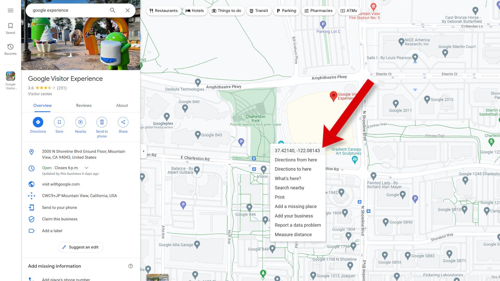
How To Use Google Maps With Coordinates

Have you ever found yourself in a situation where you need to navigate to a specific location, but the address is not available? This is where Google Maps with coordinates comes to the rescue. By using latitude and longitude coordinates, you can pinpoint an exact location on the map and get directions to it.
The purpose of using Google Maps with coordinates is to provide a more accurate and efficient way of navigating, especially in areas where addresses are not clearly defined. This method is particularly useful for outdoor enthusiasts, such as hikers and campers, who often need to navigate to remote locations. By using coordinates, you can ensure that you reach your destination safely and easily.
Getting Started with Coordinates
To use Google Maps with coordinates, you need to understand how to read and enter latitude and longitude coordinates. These coordinates are usually represented in a format such as
43.653226, -79.383184, which represents the latitude and longitude of a specific location. You can enter these coordinates into the Google Maps search bar to find the corresponding location on the map.
Must Read
One of the benefits of using Google Maps with coordinates is that it allows you to zoom in to a very specific location, which can be useful for finding small or hard-to-reach places. You can also use coordinates to create custom maps and share them with others, which can be useful for planning group trips or events. By using coordinates, you can take your Google Maps experience to the next level and unlock new possibilities for navigation and exploration.
In addition to navigating to specific locations, Google Maps with coordinates can also be used to measure distances and calculate routes between two or more points. This can be useful for logistics and transportation companies, as well as for athletes and fitness enthusiasts who need to track their routes and distances. By using latitude and longitude coordinates, you can get accurate and reliable data that can help you plan and optimize your routes.

Tips and Tricks for Using Coordinates
To get the most out of Google Maps with coordinates, it's a good idea to practice entering coordinates and experimenting with different formats and notations. You can also use online tools and converters to help you generate and convert coordinates, which can save you time and effort. By mastering the use of coordinates, you can become a power user of Google Maps and unlock new possibilities for navigation and exploration.
Google Maps with coordinates is a powerful tool that can be used in a variety of contexts, from outdoor adventure to urban navigation. Whether you're a seasoned explorer or just starting to learn about coordinates, this feature can help you navigate the world with greater ease and accuracy. So why not give it a try and see where Google Maps with coordinates can take you?

As you become more comfortable using Google Maps with coordinates, you can start to explore new features and tools that can help you take your navigation to the next level. For example, you can use GPS devices and mobile apps to track your location and receive turn-by-turn directions, even in areas with limited internet connectivity. By combining Google Maps with coordinates and other technologies, you can create a powerful navigation system that can help you navigate even the most challenging environments.
In conclusion, using Google Maps with coordinates is a fun and useful skill that can be applied in a variety of contexts. By mastering the use of latitude and longitude coordinates, you can unlock new possibilities for navigation and exploration, and take your Google Maps experience to the next level. So why not start experimenting with coordinates today and see where they can take you?

:max_bytes(150000):strip_icc()/004_latitude-longitude-coordinates-google-maps-1683398-5bcfca7e46e0fb0026d21fe7.jpg)
:max_bytes(150000):strip_icc()/201-latitude-longitude-coordinates-google-maps-1683398-3a08695119124e33a5634c558bba8fcf.jpg)

:max_bytes(150000):strip_icc()/301-latitude-longitude-coordinates-google-maps-1683398-65fcbcd32d774eb4a8e865a495987818.jpg)